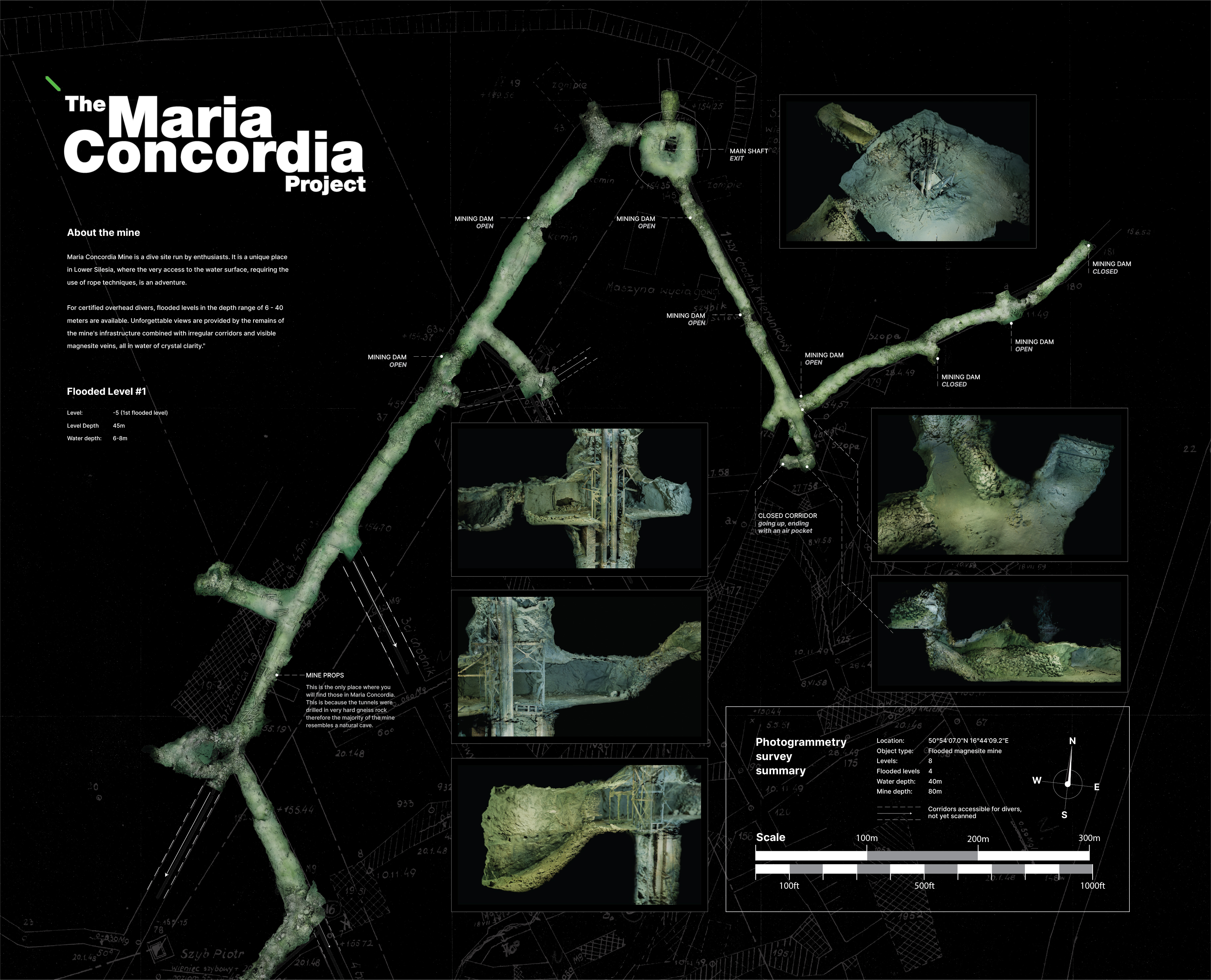
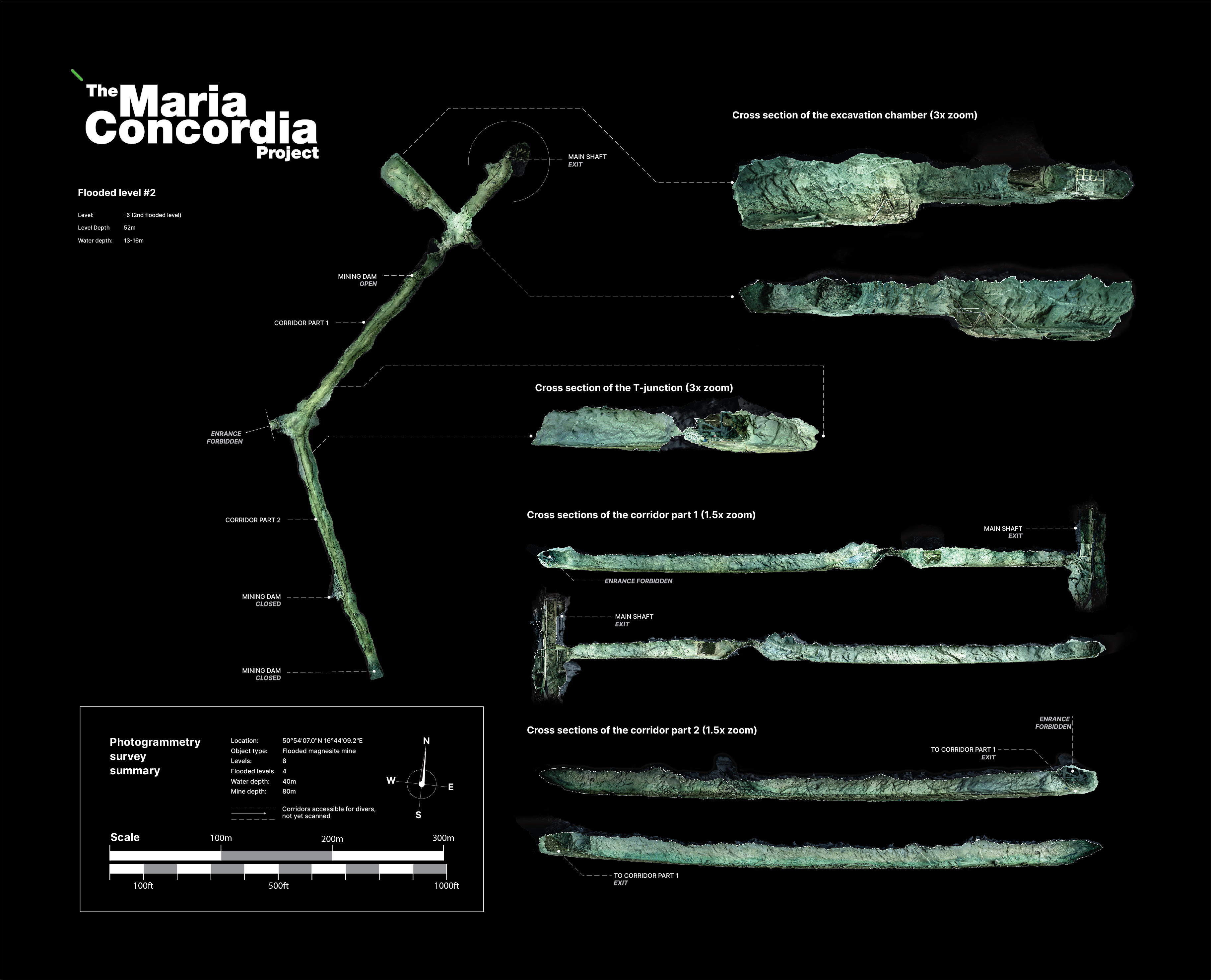
Before diving this phenomal mine, take your time to review the maps created using the photgrammetry 3d scan of the corridors. So far we can offer you level 1 and 2 (the most vast ones)
Even though the entrances to quite a few corridors are sealed, 1st level at 8m depth (ca. 45 m below the surface) is a place well worth visiting. We start of in an excavation chamber surrounding the main shaft. From there, 3 exits invite us to explore further. While one of them leads us to just a single chamber, the other two can be a beginning of a grand adventure. Take a close look at the map below and plan your dive!
The next level is just a bit deepr, about 14m below the water surface. Unlike 1st level, it doesn't start with any chamber - it's just an opening in the main shaft's wall, easy to miss if you don't know it's there. When diving, keep in mind that the silt is extremely easy to stir up, so dive carfully. The visibility can drop rapidly, from crystal-clear to zero within seconds.
Take time to review a virtual dive video below, presenting a major part of the 1st level. It can give you a good understanding of what to expect when diving the Maria Concordia mine.