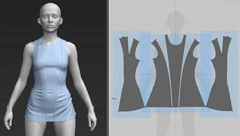
3D Scanning in Sportswear Design and Fit
In design studios where precision meets performance, 3D scanning has begun to redefine how sportswear is created and experienced. What was once guided by standard sizing and generalized patterns is now shaped by exact body data. …

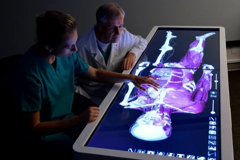
3D Scanning in Sports Medicine and Rehabilitation
Within clinical environments where recovery is measured in small, precise steps, 3D scanning has introduced a new way of seeing the human body. Instead of relying solely on observation or manual measurement, specialists can now work with detailed digital representations …
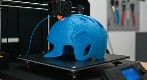
3D Scanning in Custom Sports Equipment Design
In the evolving landscape of athletic innovation, 3D scanning has begun to reshape how sports equipment is imagined, measured, and ultimately created. What was once based on standardized sizing and approximation is now guided by precision, where every contour of …
3D Scanning for Injury Prevention in Sports
In high-performance environments, where the margin between peak condition and physical breakdown is often measured in millimeters, 3D scanning has emerged as a quiet but powerful safeguard.…

3D Body Scanning in Modern Sports Training
At the intersection of innovation and performance, 3D scanning has begun to redefine how athletes understand their own bodies. No longer limited to observation or estimation, training now relies on precise digital models that reveal structure, symmetry, and imbalance with …